SKI AREAS • COLORADO
SKI COOPER
May 16, 2024
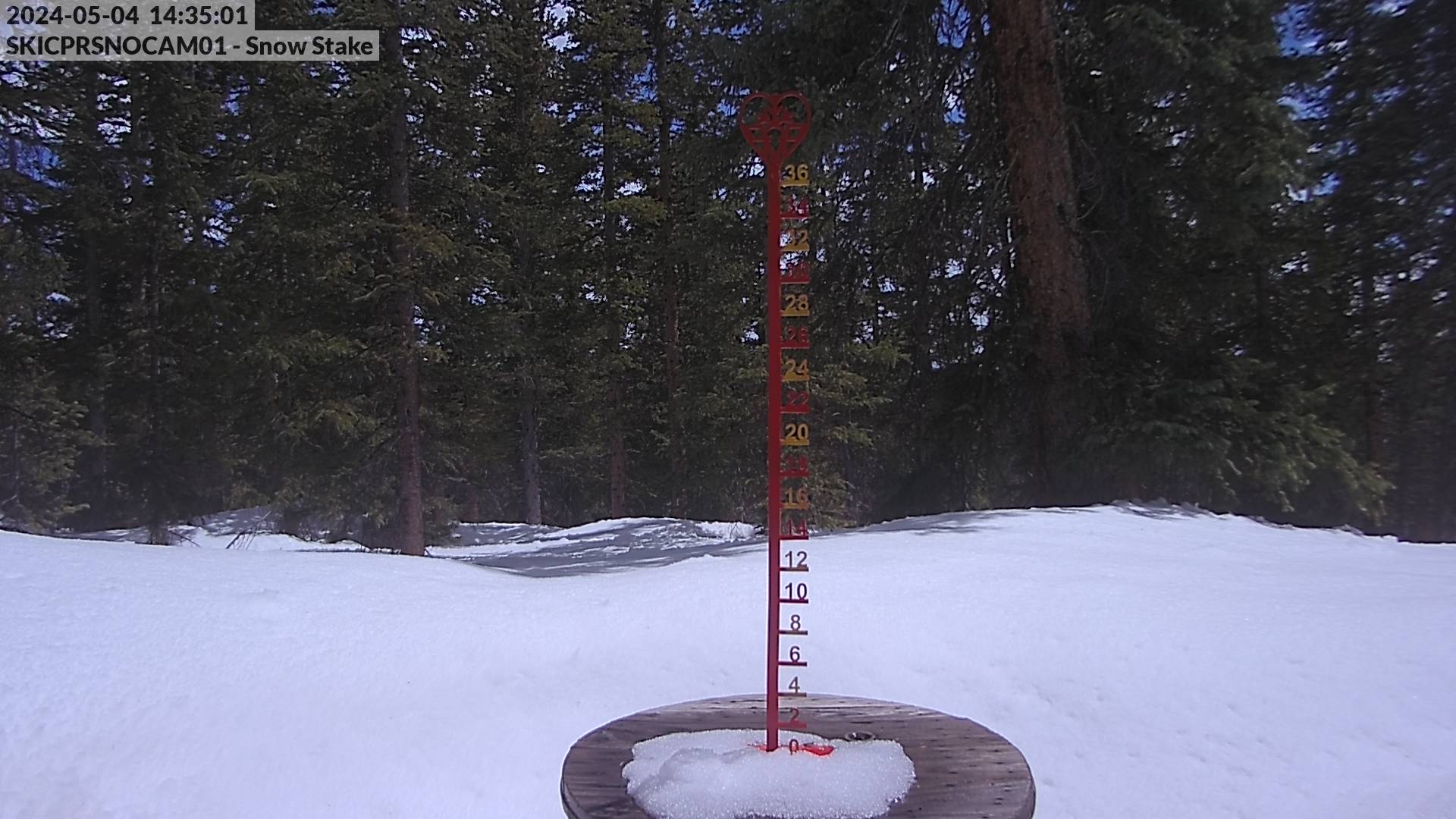
47.0" Snowpack (153% of Normal)
•
Hydrologic Outlook
Until 2024-05-24T05:15:00-06:00 • National Weather Service
ESFPUB This statement is primarily for areas below Turquoise Lake along Lake Fork Creek, downstream to the Arkansas River confluence within Lake County. This statement is valid from May 15 to June 30, 2024. The potential for elevated river levels and inundation of low-lying areas, due to increased releases from Sugar Loaf Dam, is higher than normal for areas along Lake Fork Creek in Lake County. ...OUTLOOK FOR THE NEXT 45 DAYS... In order to make room for anticipated inflows to Turquoise Lake from snowmelt runoff, and to prevent an uncontrolled spill from Sugar Loaf Dam, The U.S. Bureau of Reclamation will increase reservoir releases to 450 cfs beginning Wednesday May 15 and continuing through June 30, 2024. This release is expected to continue to inundate and cause damage to County Road 5 in Lake County. Local authorities and the U.S. Bureau of Reclamation have been actively notifying those downstream of Sugar Loaf Dam of these anticipated impacts that could last through late June, and mitigation measures to help fortify County Road 5 and other areas are currently being made. At this time, no additional flooding or impacts are expected further downstream along Lake Fork Creek, or beyond its confluence with the Arkansas River. Please continue to heed all road closures and additional orders from local law enforcement and emergency management. ...ADDITIONAL INFORMATION... For the latest information on reservoir conditions and releases from Sugar Loaf Dam at Turquoise Lake, please contact Anna Perea, Public Affairs Specialist with the U.S. Bureau of Reclamation, at aperea@usbr.gov For the latest weather information and alert notifications for Lake County, visit our web site at weather.gov/pub For more hydrologic information including graphs of probabilistic river outlooks and forecasts, visit the National Water Prediction Service page at water.noaa.gov
No new snow to report today, with snowpack levels sitting at 47.0".
Weather today, a 20 percent chance of snow showers after 1pm. some thunder is also possible. mostly sunny, with a high near 48. light and variable wind becoming north northwest 5 to 7 mph in the afternoon. Up to 1" of more snowfall forecasted over the next 5 days.
None Read More
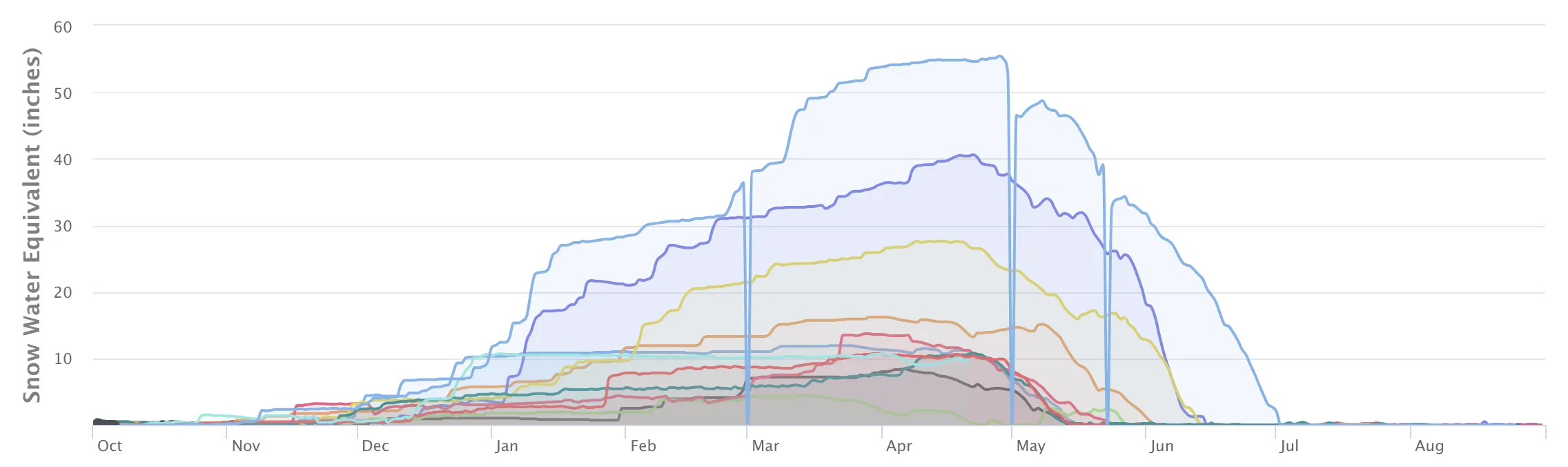
Snowpack Depth (Past 7 Days)
Data sourced from Buckskin Joe
Recent Air Temperatures