


PAYETTE LAKE AT MCCALL ID
Reservoir Levels • Weather • Hydrology
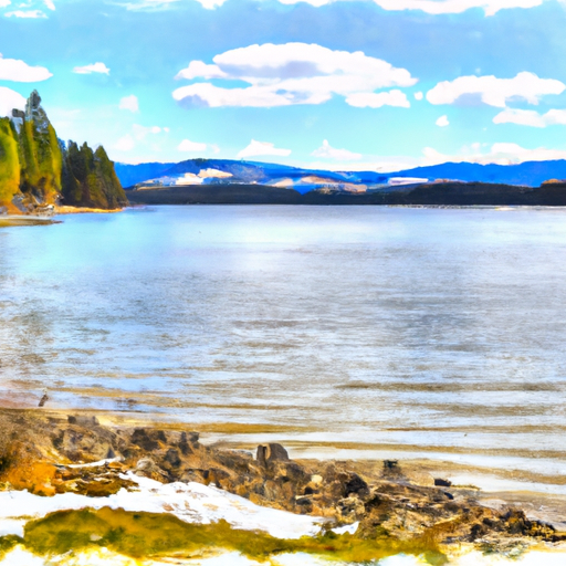
Payette Lake, located in McCall, Idaho, is a natural glacial lake that was first discovered in the early 1800s. The lake has a surface area of 5,330 acres and a maximum depth of 392 feet. The hydrology of the lake is primarily fed by snowmelt and precipitation from surrounding mountain ranges, with the Payette River being the main outlet.
Specific surface flow providers include the North Fork and the South Fork, both of which contribute to the overall water quality of the lake. The snowpack, which is the primary source of water for the lake, is monitored by the Natural Resources Conservation Service. The lake is used for a variety of recreational activities, including boating, fishing, and swimming, and is also an important source of water for agriculture in the surrounding area.
May 17, 2024
°F
°F
mph
Windspeed
%
Humidity
Explore the Interactive Map
View recreational hotspots like fishing, camping, and parks, alongside climate-related data such as river levels, snowpack, and weather forecasts. Enjoy 3D mapping for an immersive experience, and switch to satellite view for a detailed look at your favorite spots. Simply click, explore, and discover nature like never before!

Points of Interest
You Might Like
Explore Nearby Places
 Packer John's Cabin State Park
Packer John's Cabin State Park is a beautiful state park located in the state of Idaho. There are many good reasons to visit this park. One of the main reasons is the stunning scenery and natural beauty that can be found in the area. Visitors can enjoy hiking, fishing, camping, and wildlife viewing in the park. One of the main points of interest in Packer John's Cabin State Park is the historic Packer John's Cabin. This cabin was built in the late 1800s and has been preserved as a historic landmark. Visitors can explore the cabin and learn about the ...