
WELCOME
Snoflo is the ultimate platform for outdoor enthusiasts and climate-conscious individuals. We offer climate data, weather forecasts, and the best recreation spots nearby. Explore more, impact less with Snoflo. Learn More.


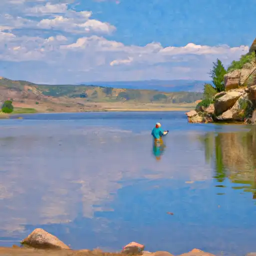
RIFLE GAP RESERVOIR
Reservoir Levels • Weather • Hydrology
Rifle Gap Reservoir is located in Garfield County, Colorado and was created in 1967 as a water storage project for the Colorado River Basin. The reservoir is fed by the Rifle River and East Fork Parachute Creek, providing water for irrigation and domestic use. It has a storage capacity of 14,657 acre-feet and a surface area of 350 acres. The reservoir is surrounded by Rifle Gap State Park, which offers recreational activities such as fishing, boating, camping, and hiking. The area receives an average of 23 inches of snowfall per year, which contributes to the reservoir's water supply. The reservoir is also used for hydroelectric power generation, with a capacity of 10 megawatts. Overall, Rifle Gap Reservoir is an important source of water and recreation for the surrounding communities.
May 17, 2024
°
°
mph
Windspeed
%
Humidity
Explore the Interactive Map
View recreational hotspots like fishing, camping, and parks, alongside climate-related data such as river levels, snowpack, and weather forecasts. Enjoy 3D mapping for an immersive experience, and switch to satellite view for a detailed look at your favorite spots. Simply click, explore, and discover nature like never before!

Points of Interest
You Might Like
Explore Nearby Places

Wilderness Flat Tops, located in the state of Colorado, is a pristine and breathtaking destination for outdoor enthusiasts and nature lovers. This vast wilderness area offers numerous reasons to visit, including its stunning landscapes, diverse wildlife, and a wide range of recreational activities. One of the main attractions in Wilderness Flat Tops is the scenic beauty of its alpine meadows, deep canyons, and towering peaks. The area is particularly known for its unique flat-topped mountains, which provide stunning panoramic views. Visitors can also explore the many crystal-clear lakes and rivers that dot the landscape, offering excellent opportunities for fishing, kayaking, ...