
WELCOME
Snoflo is the ultimate platform for outdoor enthusiasts and climate-conscious individuals. We offer climate data, weather forecasts, and the best recreation spots nearby. Explore more, impact less with Snoflo. Learn More.
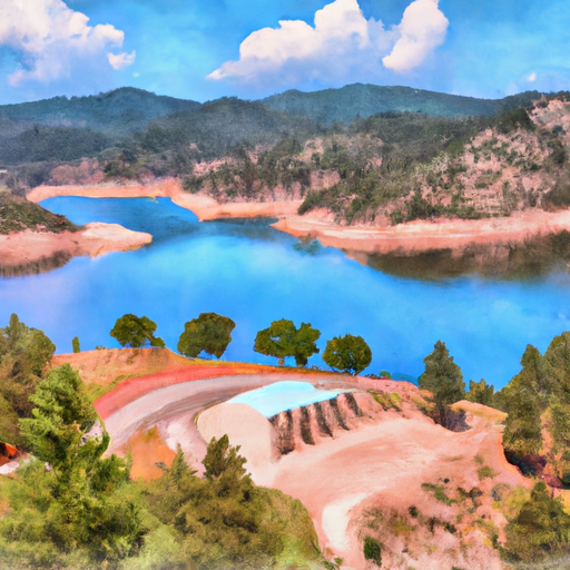


MORROW POINT RESERVOIR
Reservoir Levels • Weather • Hydrology
Morrow Point Reservoir is located in southwestern Colorado and was completed in 1968. The reservoir is fed by several streams, including the Gunnison River, and is part of a larger hydroelectric power generation system. The reservoir has a maximum depth of 400 feet and a surface area of over 1,800 acres.
The hydrology of the reservoir is heavily influenced by snowpack in the surrounding mountains, with the runoff providing much of the water for the reservoir. Agriculture is an important user of the water from Morrow Point Reservoir, with irrigation systems drawing from the reservoir to water crops in the surrounding valleys.
Recreational uses of the reservoir also abound, with fishing, boating, and camping being popular activities. The area around the reservoir is also home to several hiking trails and other outdoor recreational opportunities. Overall, Morrow Point Reservoir plays an important role in providing water for agriculture and power generation in the region, while also offering a variety of recreational opportunities for visitors.
May 16, 2024
°
°
mph
Windspeed
%
Humidity
Explore the Interactive Map
View recreational hotspots like fishing, camping, and parks, alongside climate-related data such as river levels, snowpack, and weather forecasts. Enjoy 3D mapping for an immersive experience, and switch to satellite view for a detailed look at your favorite spots. Simply click, explore, and discover nature like never before!

Points of Interest
You Might Like
Explore Nearby Places

Herron Park is a beautiful outdoor recreational area located in the state of Colorado. The park offers an idyllic escape for visitors seeking a serene natural setting. It spans over 340 acres and is situated at an altitude of 5,600 feet above sea level. One of the reasons to visit Herron Park is to experience its breathtaking views of the surrounding Rocky Mountains. Visitors can hike along the park's many trails, which offer various levels of difficulty for hikers of all skill levels. The park is also perfect for picnics, camping, and wildlife watching, especially during the warmer months. There ...