
WELCOME
Snoflo is the ultimate platform for outdoor enthusiasts and climate-conscious individuals. We offer climate data, weather forecasts, and the best recreation spots nearby. Explore more, impact less with Snoflo. Learn More.


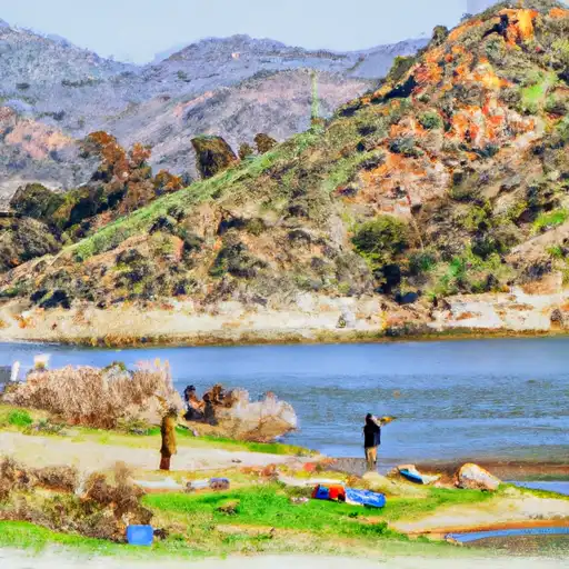
Lake Piru
Reservoir Levels • Weather • Hydrology
Lake Piru is situated in Ventura County, California, and it was formed in 1955 with the construction of the Santa Felicia Dam. It is a reservoir that is fed by the Piru Creek, which originates in the San Emigdio Mountains. The Piru Creek provides the lake with its primary source of surface flow, and the area also receives water from snowpacks in the mountains. The lake is used for both agricultural and recreational purposes, with agricultural water being released downstream to irrigate farms, and recreational activities like boating and fishing are popular. The lake is also home to a diverse range of flora and fauna, including birds, fish, and aquatic plants. In recent years, the lake has faced challenges with drought and low water levels, leading to concerns about its long-term sustainability.
May 16, 2024
°
°
mph
Windspeed
%
Humidity
Explore the Interactive Map
View recreational hotspots like fishing, camping, and parks, alongside climate-related data such as river levels, snowpack, and weather forecasts. Enjoy 3D mapping for an immersive experience, and switch to satellite view for a detailed look at your favorite spots. Simply click, explore, and discover nature like never before!

